
Southern Utah Road Trip: The Thoughtful Traveler's Guide Beyond the Crowds
Discover Southern Utah's hidden gems on this 10-day road trip. From Zion to Capitol Reef, explore beyond the crowds with cultural experiences & local insights.
Picture this: you're standing at sunrise in Capitol Reef National Park, the only person for miles, watching golden light paint ancient petroglyphs while biting into warm pie from a century-old fruit orchard. No crowds. No Instagram hordes. Just you, the desert, and a profound sense of connection to this remarkable landscape.
This is the Southern Utah most travelers never experience, and it's exactly what you'll discover on this thoughtfully crafted 10-day road trip.
While everyone else is elbowing for space at Delicate Arch and Angel's Landing, you'll be exploring slot canyons that feel like nature's cathedrals, supporting family-owned restaurants that have served travelers for generations, and learning the deeper stories that make these red rock landscapes sacred.
This isn't just another "hit the Mighty 5 and check the boxes" itinerary. This is a guide for travelers who want to experience Southern Utah the way it deserves to be experienced: slowly, intentionally, and with respect for the land and communities that call it home.
What You'll Find in This Guide:
A thoughtfully paced 10-day itinerary that balances iconic parks with hidden gems
Cultural and historical context for each destination
Practical tips for avoiding crowds and traveling sustainably
Honest recommendations for where to stay, what to skip, and when to go
Local businesses and experiences that support the communities you're visiting
Let's plan a road trip that changes how you see travel.
Planning Your Southern Utah Road Trip
Best Time to Visit: Spring & Fall Deep Dive
The short answer: April-May and September-October are ideal. But here's what that really means for your experience.
Spring (April-May):
Wildflowers bloom across the desert (peak: mid-April to early May)
Temperatures range from 60-80°F, perfect for hiking
Waterfalls are flowing from snowmelt (a rare sight in the desert!)
Moderate crowds, but manageable if you start hikes early
Occasional rain showers (actually beautiful in the desert)
Pro tip: Visit during the week, especially mid-April, before spring break ends
Fall (September-October):
Golden aspens and cottonwoods (peak: late September-early October)
Comfortable temps: 50-75°F with crisp mornings
Fewer families (school is back in session)
Excellent light for photography, warm and soft
Harvest season in Capitol Reef's orchards
Pro tip: The first two weeks of October offer the sweet spot between weather and crowds
What About Summer? I'll be honest: unless you're a heat warrior, avoid June-August. Temperatures regularly exceed 100°F, making midday hiking dangerous. If you must visit in summer, hike at dawn, rest during midday heat, and resume activities after 5 pm. Bring twice as much water as you think you need.
Winter (November-March): This is my secret favorite time. Hear me out: Yes, some high-elevation roads close. Yes, nights are cold. But the parks are nearly empty, light is magical, and snow on red rocks is otherworldly. Just be prepared for winter driving and check road conditions daily.'
This post contains affiliate links. I may earn a commission if you purchase through my links, at no extra cost to you.
How Many Days Do You Need? (7 vs 10 vs 14 Days)
7 Days: Possible, but rushed. You'll hit Zion, Bryce, Arches, and Canyonlands, but you'll be driving a lot and won't have time for hidden gems. Best for: repeat visitors or those with limited time.
10 Days: The sweet spot (this guide's focus). You'll experience all five national parks without feeling rushed, plus time for Escalante and scenic byways. Best for: first-timers who want a complete experience.
14 Days: Luxury pace. Add Capitol Reef's backcountry, Monument Valley, or extend time in Moab for rafting/climbing. Best for: immersive travelers or those combining this with a Southwest road trip.
My Recommendation: Don't try to do this in less than 10 days. The magic of Southern Utah reveals itself slowly, when you're watching light shift across canyon walls, sharing stories with a local coffee shop owner, or spending the golden hour photographing petroglyphs. Rush, and you'll miss it.
Starting Points: Las Vegas vs Salt Lake City
Las Vegas (Recommended for this itinerary):
Closer to Zion (2.5 hours) and Bryce (3.5 hours)
More flight options and typically cheaper flights
Interesting contrast: Vegas excess → desert minimalism
Easy to grab supplies at REI or a local grocery store before heading out
Route: Vegas → Zion → Bryce → Escalante → Capitol Reef → Moab → Return via I-70
Salt Lake City:
Better if you're doing the route in reverse (Moab first)
Closer to Arches and Canyonlands (4 hours)
Good option if combining with Park City or ski areas
Route: SLC → Moab → Capitol Reef → Escalante → Bryce → Zion → Vegas
Compare flights on Booking.com and set price alerts. I've saved hundreds by booking on Tuesday afternoons when airlines release deals.
Budget Breakdown: What to Expect
Here's what this trip actually costs (based on my experience and current prices):
Budget Version: $1,500-2,000 per person
Camping/budget motels: $30-80/night
Cooking most meals: $15-25/day
Gas: $200-300 (2,000+ miles round trip)
Park passes: $80 (America the Beautiful Pass)
Minimal activities: Free hiking
Mid-Range Version: $2,500-3,500 per person
Mix of hotels and unique lodges: $100-180/night
Eating out once daily: $40-60/day
Gas: $250-350
Park passes: $80
A few guided tours: $100-300
Comfort Version: $4,000-5,500+ per person
Boutique hotels and lodges: $200-400/night
All meals out: $75-100/day
Gas: $300-400
Park passes: $80
Multiple guided experiences: $500+
Hidden Costs People Forget:
Parking permits in some towns (St. George, Moab): $5-10/day
Reservation fees for popular trails: $5-10
Gear you don't have (see packing section): $100-500
Emergency supplies: $50-100
Money-Saving Tips:
Buy groceries in Springdale, Hurricane, or Moab (expensive in tiny towns)
Pack a cooler—saves $30-50/day
Share accommodations with travel companions
Visit in shoulder season (early May, late September) for better hotel rates
Use Hostelworld to find affordable lodges in Springdale and Moab, or try Hipcamp for unique camping experiences on private land.
Essential Logistics & Packing
Do You Need a 4WD Vehicle?
Short answer: No, but it helps for certain experiences.
What's accessible with 2WD:
All main park roads and viewpoints
95% of hikes and trails
Scenic Byway 12 (fully paved)
Most campgrounds and accommodations
What requires 4WD (or high clearance):
Cathedral Valley in Capitol Reef (spectacular but optional)
White Rim Road in Canyonlands (backcountry camping)
Some slot canyon trailheads in Escalante (Egypt, Spooky Gulch)
Dirt backroads to hidden petroglyphs
My Recommendation: Rent a standard SUV or crossover with decent ground clearance. This gives you access to 99% of the trip without the extra $40-60/day for 4WD. If you want Cathedral Valley or remote slot canyons, book a single-day 4WD tour instead.
What to Actually Rent:
Toyota RAV4, Honda CR-V, or similar (great ground clearance, fuel efficient)
Avoid sedans—rough dirt roads will scrape the undercarriage
Spring for unlimited mileage (you'll drive 1,500-2,000 miles)
Compare rental prices across all providers at Booking.com. Reserve early (3+ months) for best rates.
The America the Beautiful Pass: Worth It?
Cost: $80 for an annual pass
What it covers:
All five national parks on this trip (normally $35 each = $175)
2,000+ federal recreation sites nationwide
Valid for one year from the purchase month
Covers vehicle (up to 4 adults) OR pass holder + 3 adults
Math: If you're visiting 3+ national parks in a year, it pays for itself. For this trip alone, you save $95.
Where to buy:
Online at Recreation.gov (ships to your home)
At any park entrance station (but lines can be long)
REI stores (convenient if you need gear too)
What to Pack for Desert Travel
After five trips to Southern Utah, here's what actually matters:
Clothing (Layer, Layer, Layer):
Moisture-wicking base layers (My recommendations: women's & men’s tops)
Long-sleeve sun shirt (SPF rated)
Light fleece or puffy jacket (My recommendations: women’s & men’s jackets)
Convertible hiking pants (My recommendations: women’s & men’s pants)
Wide-brim hat (non-negotiable)
Buff or bandana (dust protection)
Broken-in hiking boots + camp shoes (men’s & women’s hiking boots)
Sun & Heat Protection:
SPF 50+ sunscreen (reapply every 2 hours)
Lip balm with SPF
Sunglasses (polarized recommended)
Essential Gear:
Headlamp (for slot canyons and early starts)
Trekking poles (lifesavers on steep descents)
Hydration system: 3L bladder + backup bottles
Microspikes (if visiting Oct-April)
Dry bag for slot canyons (electronics protection)
Car Essentials:
Cooler (ice is cheap at gas stations)
Emergency kit: jumper cables, tire repair, flashlight
Extra water (1 gallon per person per day minimum)
Snacks (gas stations are far apart)
Trash bags (Leave No Trace)
What NOT to Bring:
Cotton clothing (takes forever to dry, dangerous when wet)
Cheap sandals (you'll destroy them on one hike)
Excessive electronics (embrace disconnection)
Cell Service & Offline Maps
Let's be real: you'll be off-grid for significant portions of this trip.
Cell Coverage Reality:
Good: Springdale, St. George, Moab, major highways
Spotty: Park visitor centers, popular trailheads
None: Escalante area, Highway 12 stretches, backcountry
Don't rely on your phone for:
Navigation (download offline maps)
Emergency communication (see satellite device below)
Trail conditions (check at visitor centers)
Download Before You Leave:
Google Maps offline areas (entire Utah region)
GPS premium maps (topographic layers)
AllTrails Pro (trail reviews and GPX files)
Podcast episodes (long drives between parks)
Music playlists (streaming won't work)
The 10-Day Itinerary: Southern Utah's Best
Day 1: Arriving in Las Vegas + Valley of Fire
Drive Time: 1 hour from Vegas to Valley of Fire, then 2.5 hours to Springdale
Overnight: Springdale, Utah (near Zion)
Most people blast straight to Zion. You're not most people. Start with an underrated gem.
Morning in Vegas: Land by noon if possible. Pick up your rental car, grab supplies at a grocery store, and head out by 1 pm.
Afternoon: Valley of Fire State Park (1-3 pm)
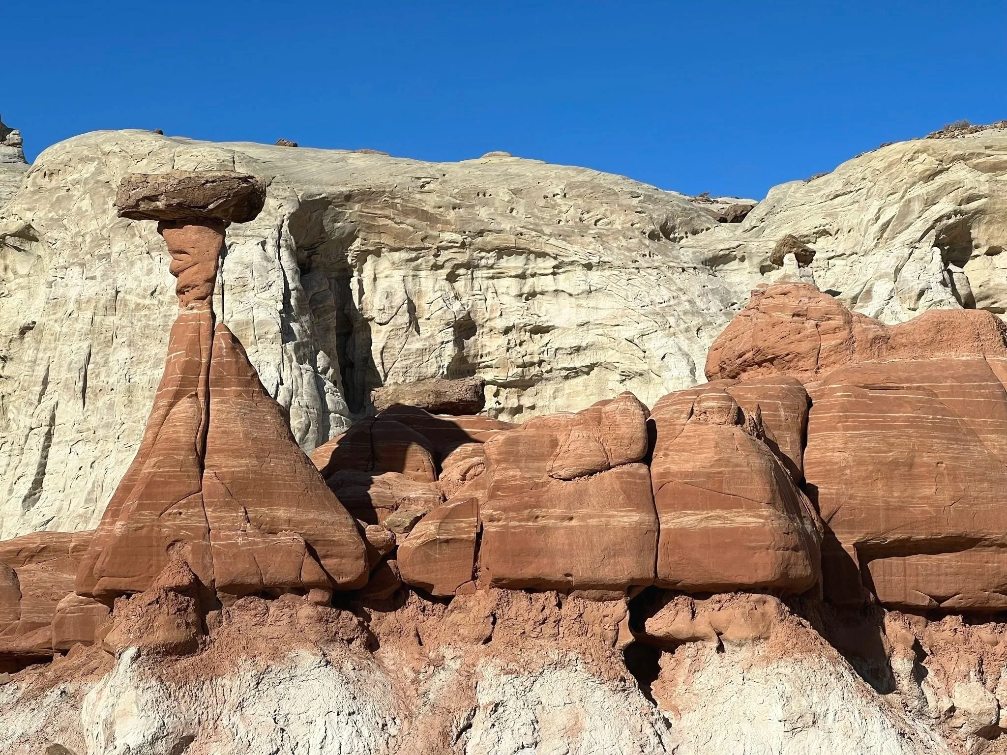
Just an hour northeast of Vegas, Valley of Fire is a stunning preview of what's to come, but without the crowds. This ancient landscape of crimson sandstone formations rivals anything you'll see later, yet most travelers skip it.
What to See:
Fire Wave Trail (1.5 miles, easy) - Swirling red and white sandstone that looks like Mars
Atlatl Rock - Ancient petroglyphs with a metal staircase for viewing
Mouse's Tank (0.8 miles) - More petroglyphs along a sandy wash
Why This Matters: These petroglyphs were created by the Ancestral Puebloans centuries ago. Take a moment to think about that. This wasn't just art for them; it was communication, storytelling, spiritual expression. We're guests in a landscape that has held meaning for thousands of years.
Entry Fee: $10/vehicle (yes, even with your America the Beautiful Pass, it's a state park)
Late Afternoon Drive to Springdale (3.5 hours): Take I-15 North through St. George. Stop at In-N-Out in St. George if you're hungry (last one for a while) or grab a better dinner once you reach Springdale.
Evening in Springdale: Check into your accommodation, explore the pedestrian-friendly town, and have dinner at Deep Creek Coffee Co. (excellent breakfast too) or Zion Pizza & Noodle Co. (casual, great pizza, housed in a converted church).
Book your Springdale stay on Booking.com. I recommend:
Budget: Zion Canyon Campground or Cable Mountain Lodge
Mid-Range: Cliffrose Springdale or Best Western Plus Zion Canyon Inn & Suites
Splurge: Desert Pearl Inn (boutique, incredible river views)
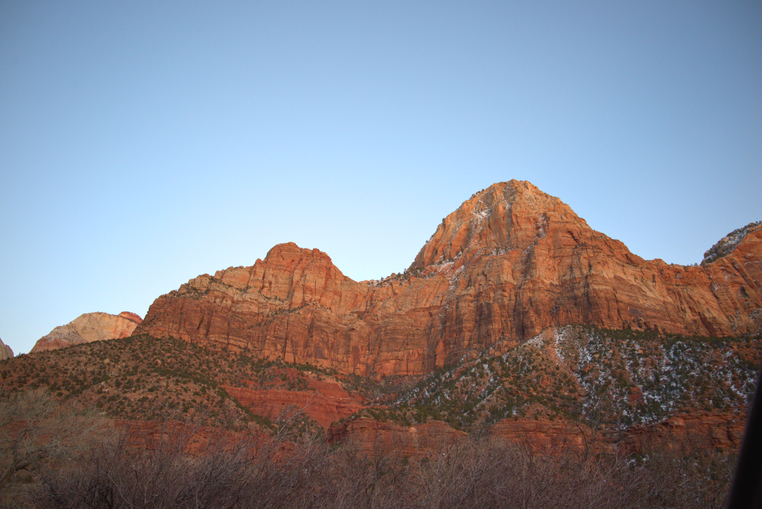
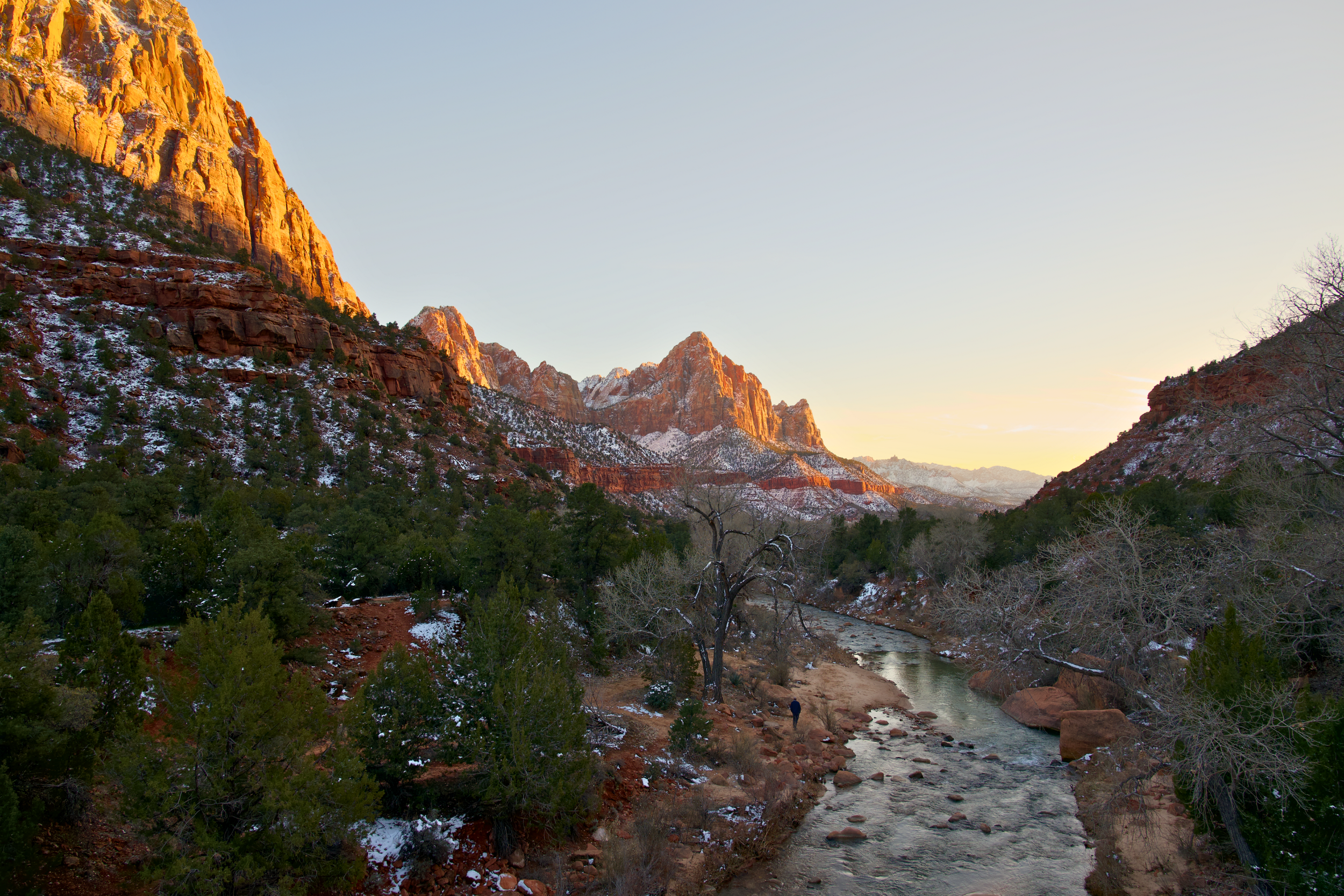
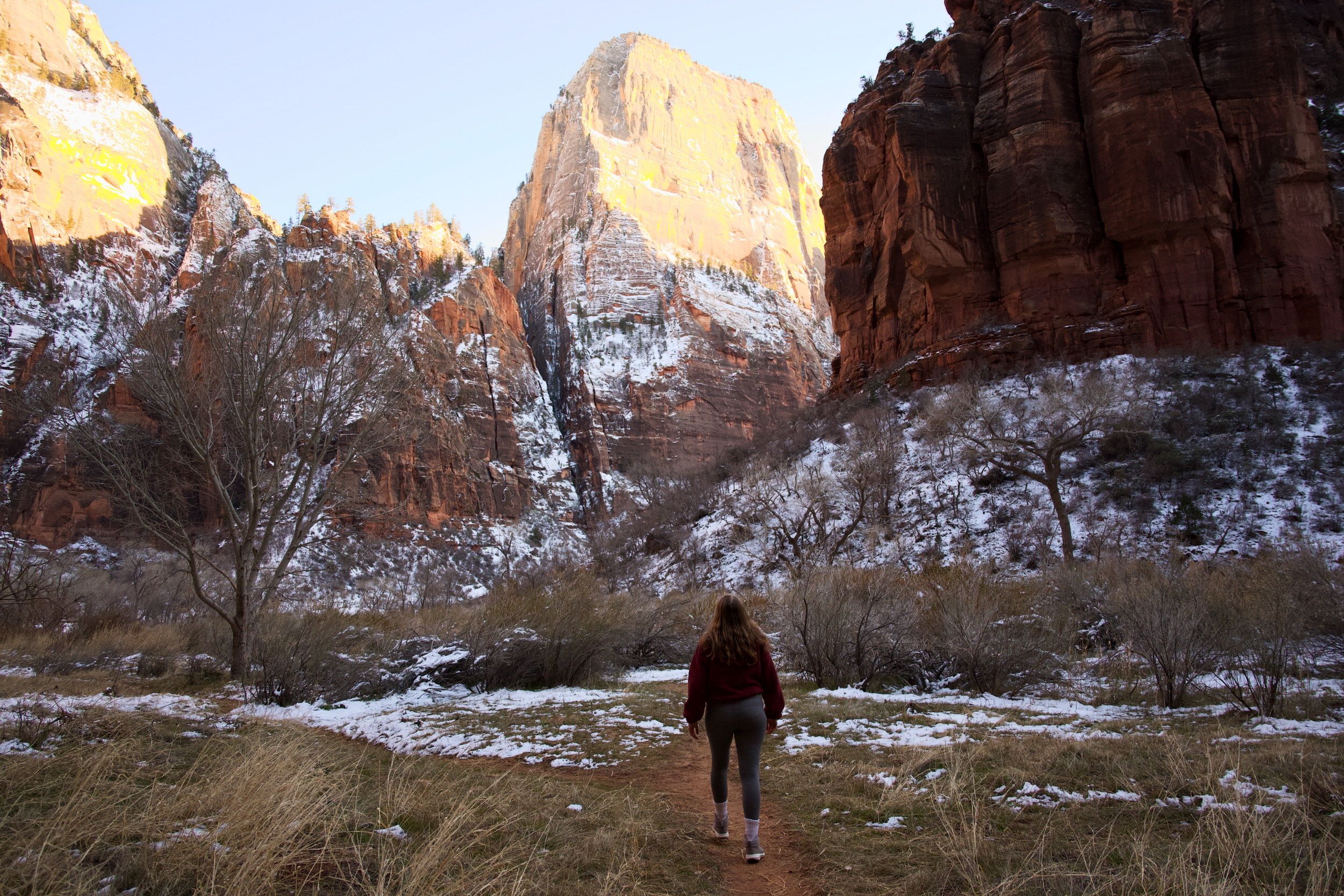
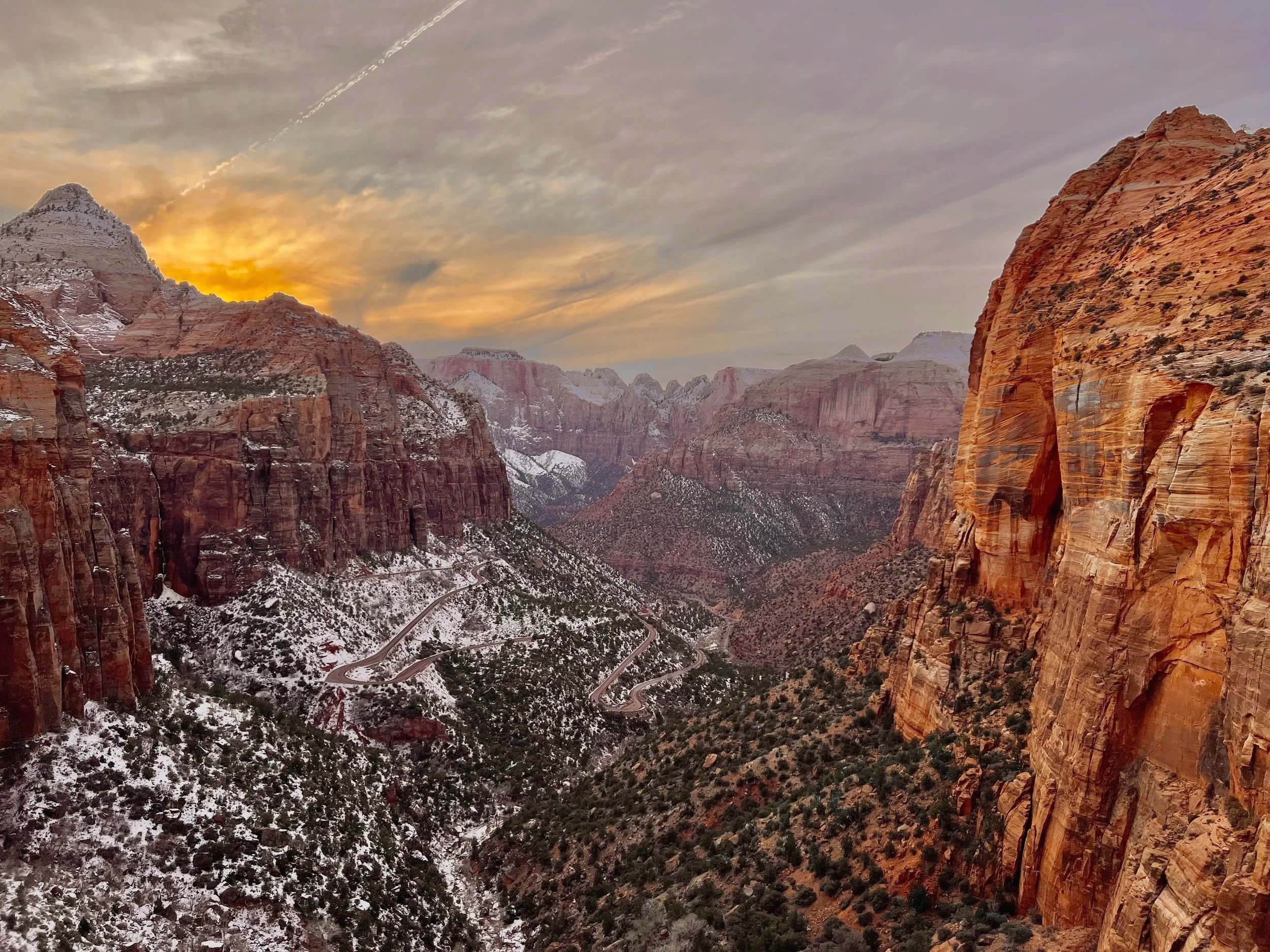
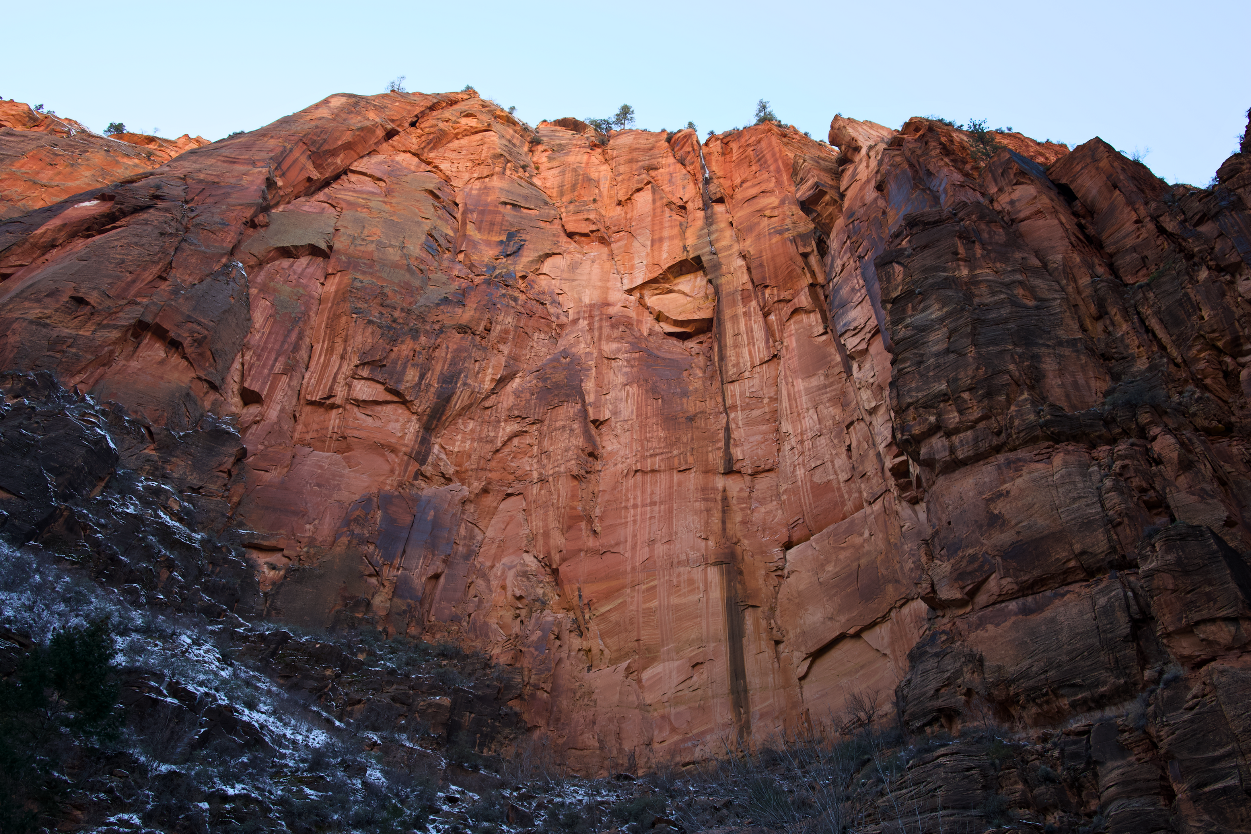
Day 2-3: Zion National Park (Beyond Angel's Landing)
Overnight: Springdale (2 nights)
Yes, Zion is crowded. Yes, Angel's Landing is iconic. But there's so much more to this park if you're willing to look beyond the Instagram hits.
Day 2: The Icons (But Smarter)
Shuttle Strategy: Zion requires a shuttle from March-November (6 am-8 pm). Here's how to beat crowds:
Catch the first shuttle at 6 am (yes, it's early, but worth it)
Or go at 4 pm onward when crowds thin
Mid-morning (10 am-2 pm) is a nightmare—avoid
Morning Hike: Angel's Landing (5.4 miles, strenuous)
I know, I know; I said "beyond" the icons. But if you've come this far, you should experience it. Just do it right:
Start at 6 am (be on the first shuttle)
You need a permit ($3, book via Recreation.gov lottery)
The chains section is genuinely exposed; skip if you're afraid of heights
Turn around at Scout Lookout if the chains feel like too much; the views are still phenomenal
Alternative if No Permit: Observation Point via East Mesa Trail (8 miles) Better views than Angel's Landing, fewer crowds, no chains or permit needed. You'll need to drive around to the east entrance, but it's worth it.
Afternoon: The Narrows (Bottom-Up, 5+ miles)
The iconic wade through the Virgin River between towering canyon walls. This is my favorite Zion experience.
Best Time: Late morning after the sun hits the canyon (better lighting)
What You Need:
Water shoes or rent canyoneering boots ($28/day at Zion Adventure Company)
Walking stick (rentable or use trekking poles)
Dry bag for phone/camera
How Far to Go:
Casual: Hike 1 hour in, turn around (2 hours total)
Committed: Push to Wall Street or Orderville Canyon (4-5 hours)
Pro Tip: Check water levels at the visitor center. If the Virgin River is above 150 CFS (cubic feet per second), it's too dangerous. Spring snowmelt can close this hike.
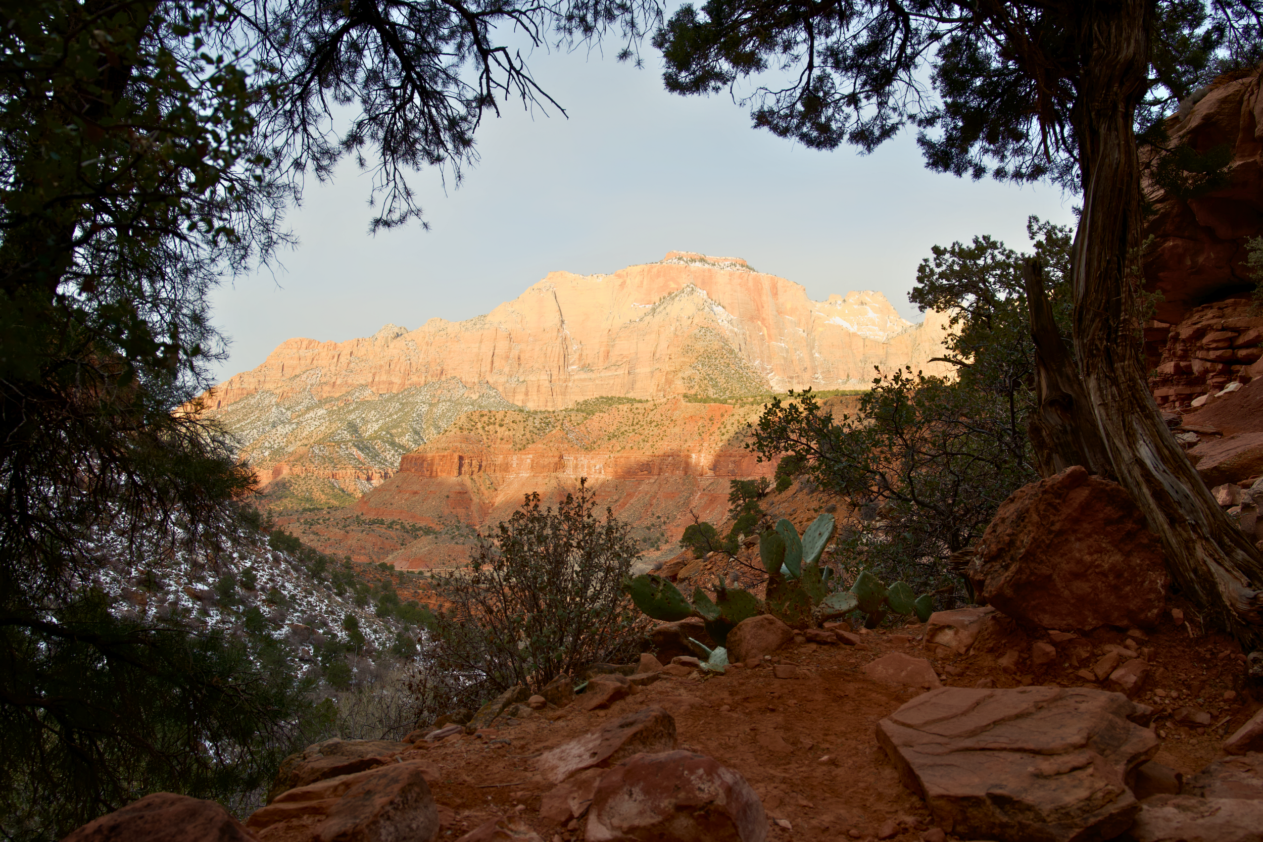
Day 3: Hidden Zion
Morning: Canyon Overlook Trail (1 mile, moderate)
My favorite short hike in Zion. Start near the east entrance tunnel; this trail offers massive views of lower Zion Canyon but sees a fraction of the crowds because it's not accessible by shuttle.
Timing: Sunrise here is magical. Drive up early (you don't need the shuttle), hike in 30 minutes, and watch the canyon glow gold.
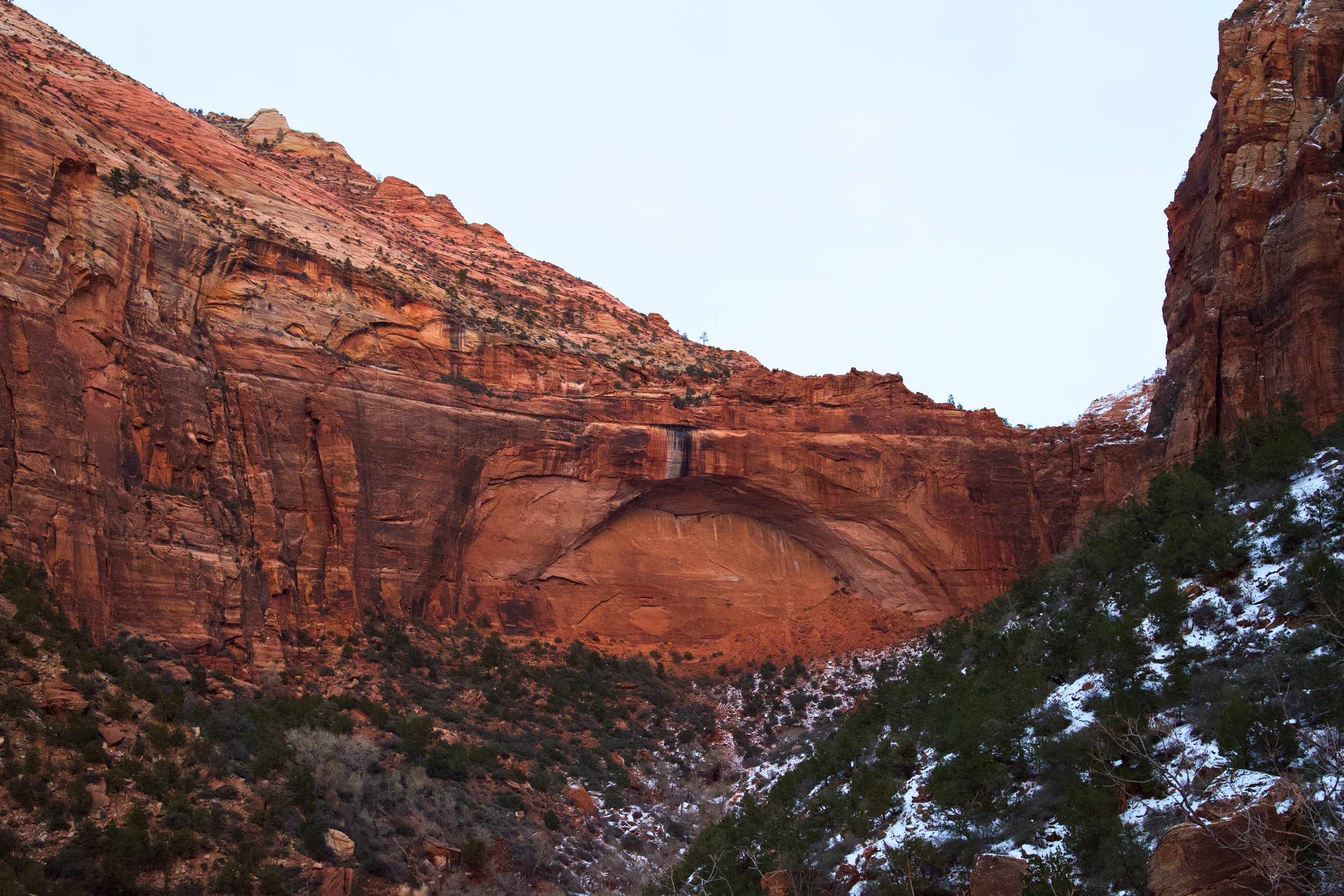
Afternoon: Kolob Canyons (The Forgotten Zion)
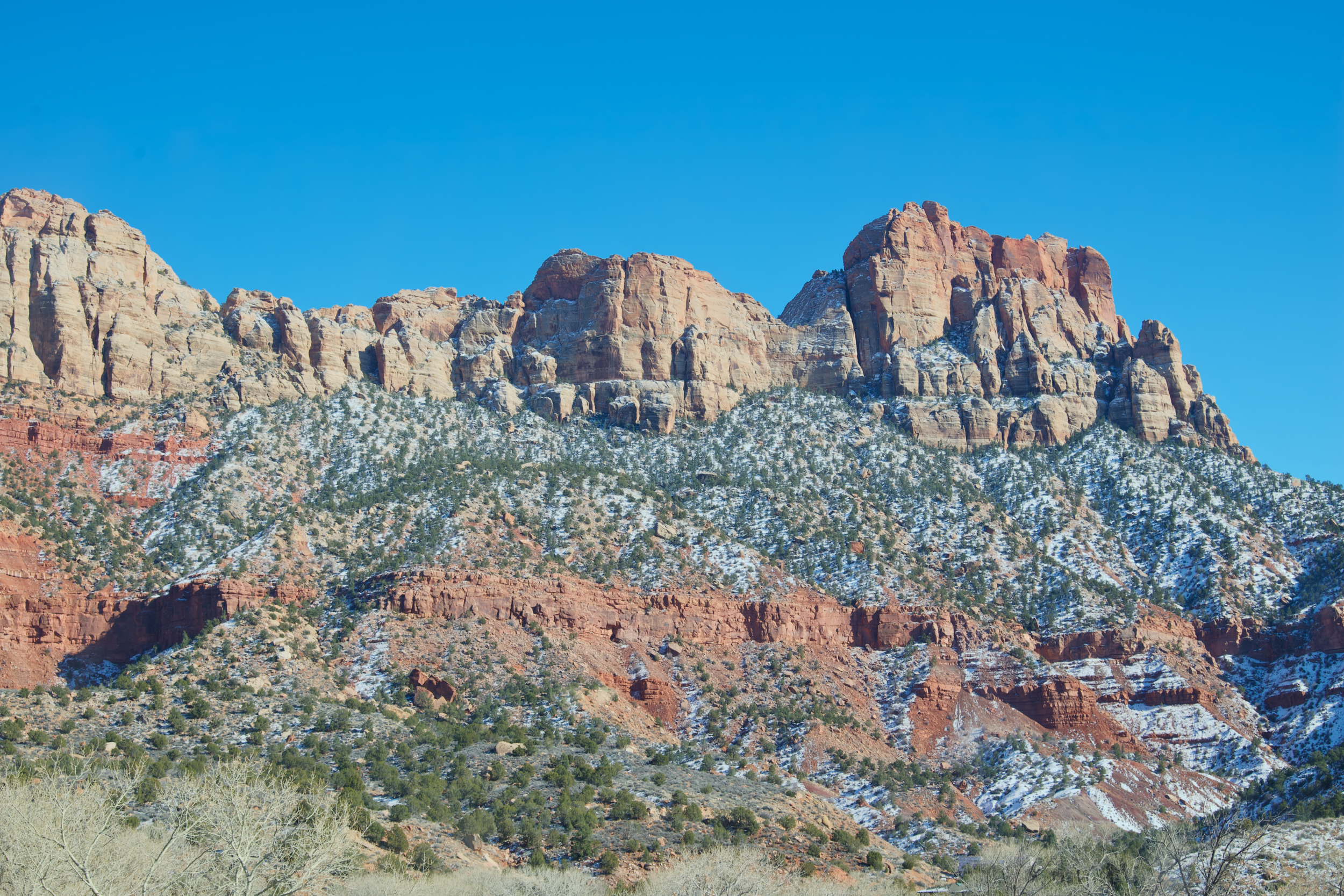
Most visitors never make it to the Kolob Canyons section in the northwest corner of the park, but it's spectacular—and empty.
Drive: 40 minutes from Springdale. Exit I-15 at exit 40.
What to Do:
Timber Creek Overlook Trail (1 mile) - Easy walk to sweeping red rock views
Taylor Creek Trail (5 miles) - Moderate hike to Double Arch Alcove
Scenic Drive: Just driving the 5-mile road is worth it
Why This Matters: Kolob Canyons receives 5% of Zion's visitors. You'll have these towering red walls almost entirely to yourself.
Evening: Return to Springdale. Eat at Whiptail Grill (Mexican with a view) or King's Landing Bistro (upscale but worth it for a celebration meal).
Book a guided photography tour of Zion's hidden spots or a sunrise jeep tour to less-visited viewpoints if you want local expertise.
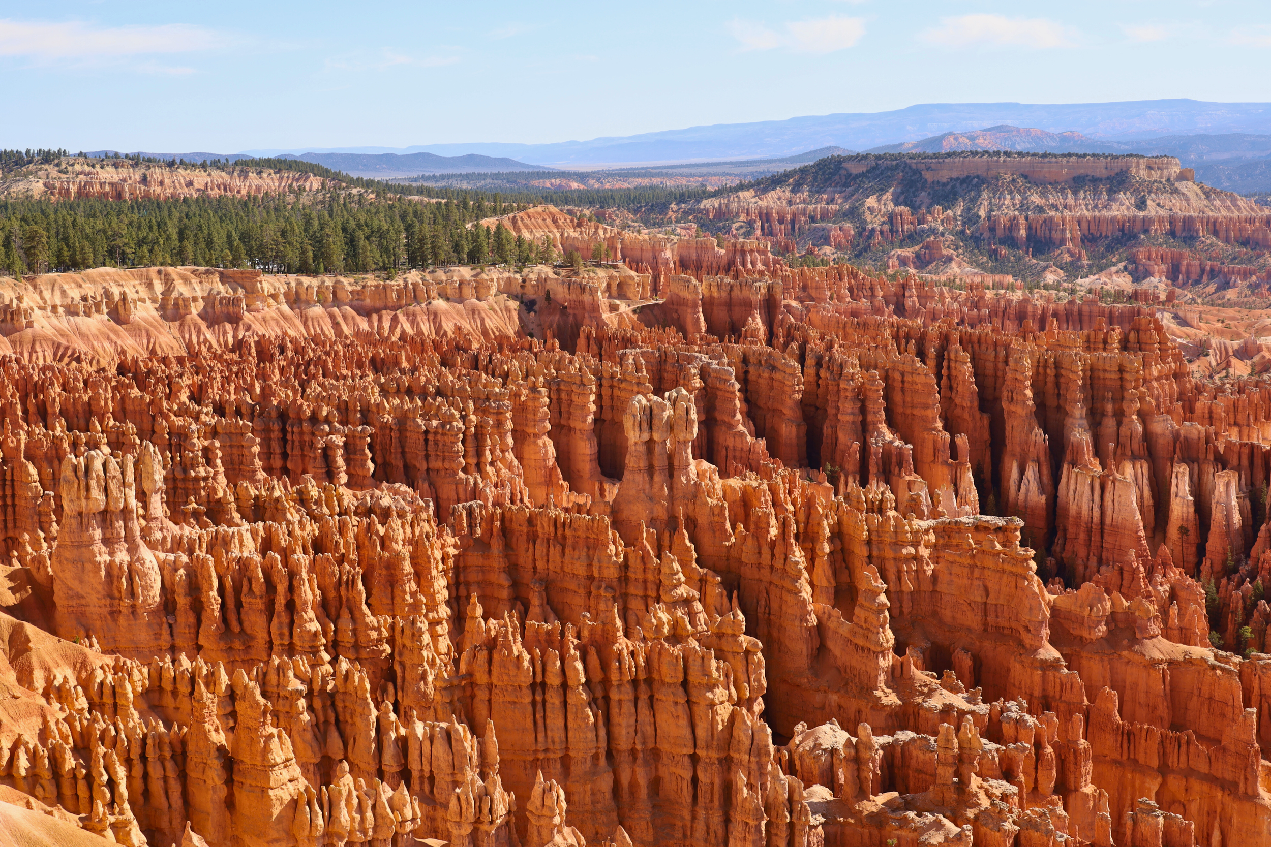
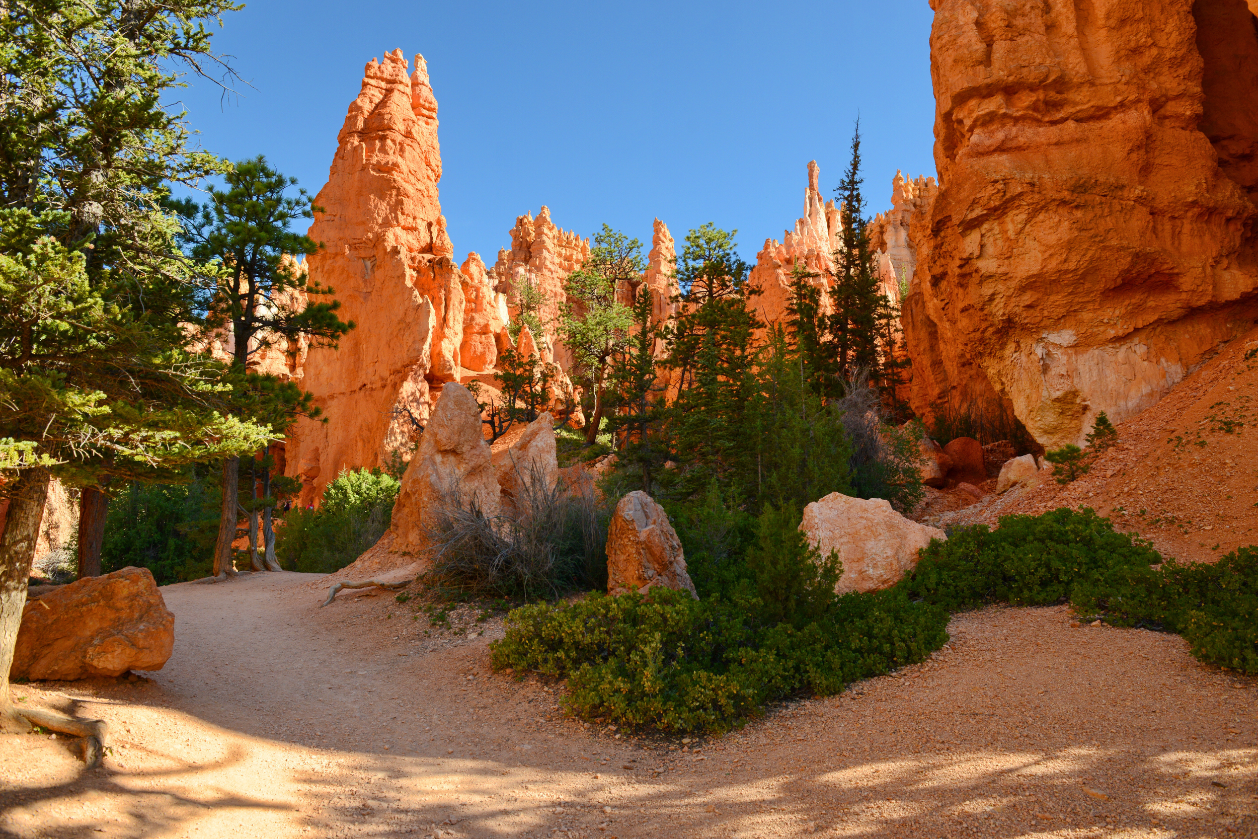
Day 4: Bryce Canyon National Park
Drive Time: 1.5 hours from Springdale to Bryce
Overnight: Bryce Canyon City or Tropic
Bryce Canyon isn't a canyon; it's a series of natural amphitheaters filled with thousands of spire-shaped rock formations called "hoodoos." It's completely unlike anything you've seen so far.
Arrival Strategy: Get there by 8 am. Sunrise at Bryce is legendary, but even mid-morning light is incredible.
Morning: Sunrise Point & Queens Garden/Navajo Loop Combo (3 miles, moderate)
Start at Sunrise Point (yes, the name is ironic if you're not here at sunrise, but the views are phenomenal any time).
Descend into the hoodoos via Queens Garden Trail (the least strenuous route down)
Connect to Navajo Loop for the famous Wall Street section (towering pines growing between narrow canyon walls)
Ascend via Navajo Loop back to Sunset Point
Walk the Rim Trail back to your car (paved, easy, stunning)
This loop takes you INTO the amphitheater, which is where the magic happens. Don't just view Bryce from the rim—you need to walk among the hoodoos to understand their scale.
Pro Tip: Hike this loop counterclockwise (Queens Garden first) to descend the gentler trail and ascend the more challenging Navajo Loop while you're still fresh.
Midday: Bryce Scenic Drive
After your hike, drive the 18-mile scenic road to the southern viewpoints:
Inspiration Point - Best overview of the amphitheater
Bryce Point - Panoramic views (perfect for understanding the park's geology)
Rainbow Point (end of the road) - 9,100 feet elevation, cooler temps, bristlecone pines
Afternoon: Peek-a-Boo Loop or Relax
If you have energy, Peek-a-Boo Loop (5.5 miles, strenuous) offers the most impressive hoodoo formations with fewer people. If you're tired, grab lunch in Bryce Canyon City and rest up—tomorrow is a big driving day.
Lunch Recommendation: Stone Hearth Grille in Tropic (farm-to-table, locally sourced) or pack a picnic.
Evening: Stay in Bryce Canyon City or Tropic. These are tiny towns (Tropic has 530 people), so book ahead.
Cultural Note: Bryce Canyon is on the traditional lands of the Paiute people. The park's visitor center has exhibits on its connection to this landscape, worth spending time to learn.
Book a horseback riding tour in Red Canyon for a unique perspective, or stay at the Lodge at Bryce Canyon for a historic national park lodge experience.
Day 5-6: Escalante & Scenic Byway 12 (The Hidden Gem)
Drive Time: 2 hours from Bryce to Escalante
Overnight: Escalante or Boulder (2 nights)
This is where the trip transforms. Most tourists rush from Bryce to Capitol Reef, spending just 90 minutes on Highway 12. You're going to spend two full days here, and you'll understand why this area is the soul of Southern Utah.
Why Escalante Deserves Two Days:
Grand Staircase-Escalante National Monument is nearly 1.9 million acres (larger than Delaware)
Some of the most stunning slot canyons in the Southwest
Population density: 1 person per square mile
No large towns, no chain restaurants, no crowds; just raw, wild Utah
Day 5: Highway 12 + Slot Canyon Exploration
Morning Drive: The Most Scenic Road in America
All-American Road designation isn't given lightly; Highway 12 earned it. This 124-mile stretch from Bryce to Capitol Reef includes:
Red Canyon (just outside Bryce) - Stop at the tunnel vista
Escalante Petrified Forest State Park - Quick 1-mile loop through fossilized wood (optional, $10)
Head of the Rocks Overlook - Pullout with views of the Aquarius Plateau
Calf Creek Recreation Area - Your hiking destination (see below)
Take your time. This isn't a drive to "get through,” it's the destination itself. Pull over at every vista, read the interpretive signs, breathe the air.
Late Morning: Lower Calf Creek Falls (6 miles round trip, moderate)
Trailhead: Mile marker 81 on Highway 12 (between Escalante and Boulder)
This is the hike I recommend to everyone. A sandy trail follows Calf Creek through a desert canyon to a 126-foot waterfall that somehow exists in this arid landscape.
What Makes It Special:
Ancient granaries built into the cliff walls (look up as you hike)
Beaver dams in the creek
The waterfall creates a swimming hole, bring a swimsuit
Petroglyphs near the falls (look but don't touch)
Timing: Start by 9 am in warm weather (no shade, gets hot). Bring extra water; rangers rescue dehydrated hikers here regularly.
Afternoon: Explore Escalante Town
Escalante (population: 797) is the kind of town that reminds you why small-town America matters.
Stop at:
Escalante Outfitters - Gear shop, coffee, pizza, local advice (the owners know every trail)
Kiva Koffeehouse - Built to resemble an Ancestral Puebloan kiva, incredible views, good coffee
Escalante Mercantile - Old-school general store, grab snacks for tomorrow
Evening Recommendation: Drive to Escalante Natural Bridge at sunset (15 min from town, short walk). You'll likely be the only one there.
Rent a 4WD vehicle for the day from local outfitter Excursions of Escalante to access remote slot canyons, or book a guided canyoneering tour.
Day 6: Slot Canyon Day
Today's Mission: Experience Utah's famous slot canyons, narrow passages carved by water through sandstone, sometimes only a few feet wide but hundreds of feet deep.
Option 1: Zebra & Tunnel Slot Canyons (5-6 miles, moderate-strenuous, 4WD required)
The striped Navajo sandstone walls of Zebra Canyon are like standing inside a painting.
Access: Hole-in-the-Rock Road (dirt, requires high-clearance 4WD or book a tour)
What to Expect:
Technical scrambling over boulders
One 12-foot downclimb using a rope (fixed)
Dry slot (no water, but still bring your dry bag)
Utterly surreal, like being in a geologist's fever dream
Option 2: Peek-a-Boo & Spooky Gulch (5 miles, moderate, 4WD helpful)
More accessible but still spectacular. Spooky Gulch is a narrow slot canyon.
Access: Hole-in-the-Rock Road (25 miles, rough but doable in SUV with high clearance in dry conditions)
Option 3: Willis Creek (4 miles, easy, NO 4WD needed!)
If you don't have 4WD or want something less intense, Willis Creek is perfect. You'll wade through a slot canyon with a small creek, surrounded by towering walls. It's gorgeous and accessible.
Access: Off Highway 89, south of Escalante
Safety Reminder:
NEVER enter slot canyons if rain is forecast; flash floods kill people
Check the weather and flash flood potential at the visitor center EVERY morning
Tell someone your plan and the expected return time
Afternoon: Scenic Byway 12 to Boulder
Continue on Highway 12 toward Boulder. This section crosses Hogback Ridge, a narrow ridge with 1,000-foot drop-offs on both sides. Stop at the pullout and look both ways. It's vertigo-inducing.
Overnight: Stay in Boulder at the Boulder Mountain Lodge (mid-range, excellent restaurant) or continue to Torrey (20 more minutes)
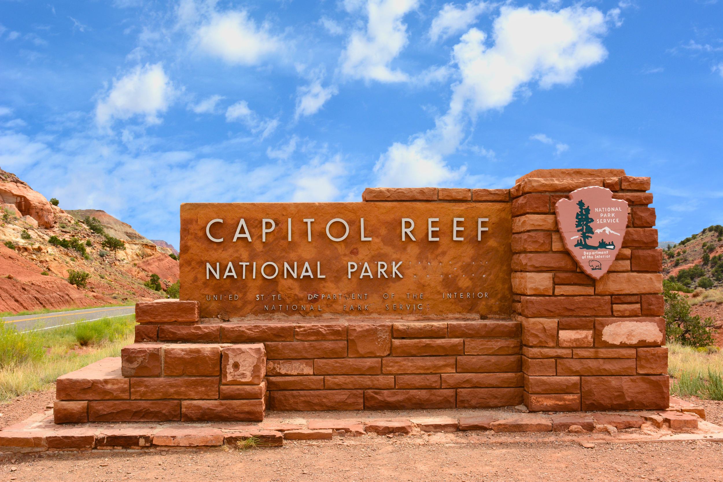
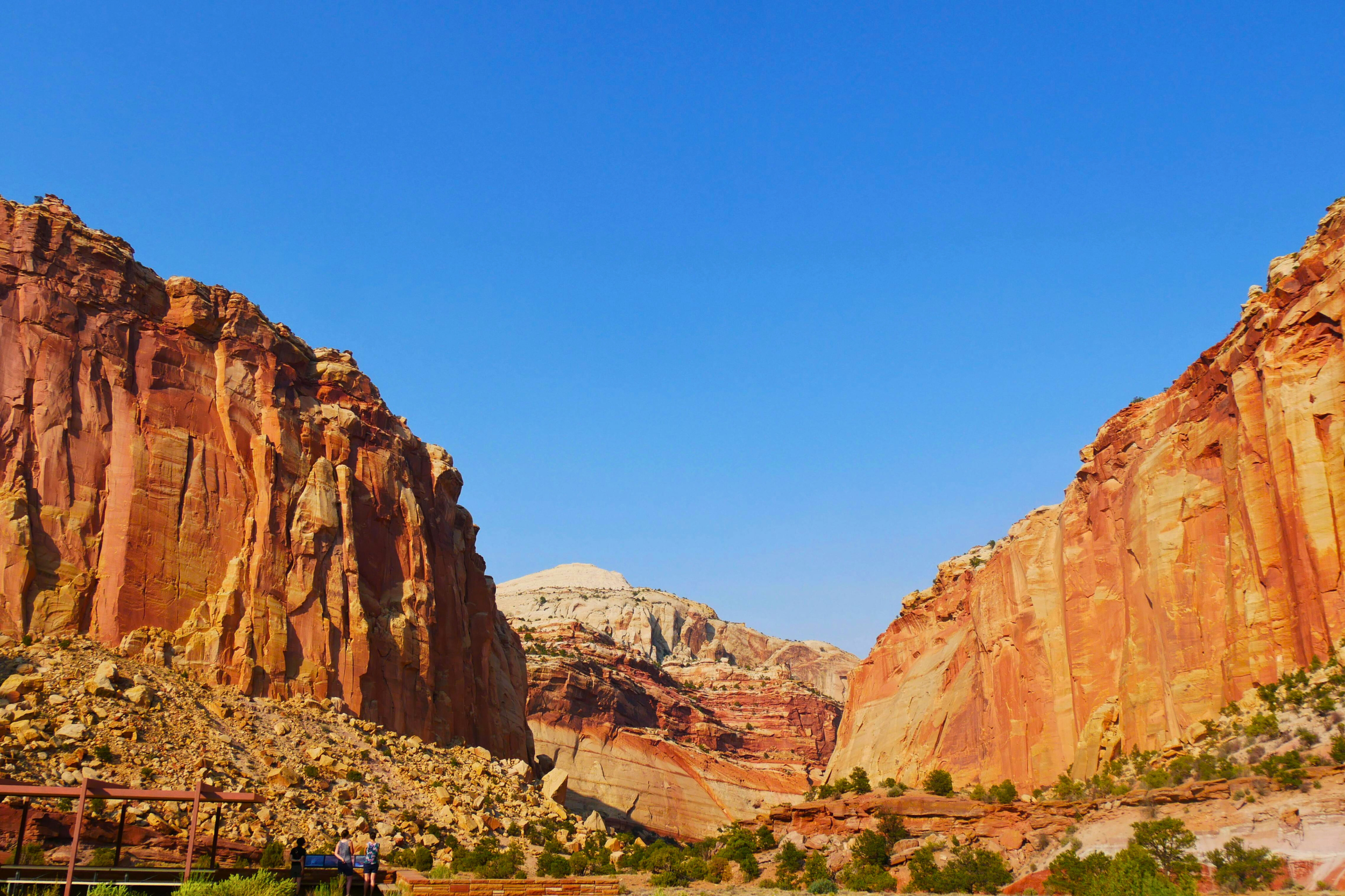
Day 7: Capitol Reef National Park (The Underrated One)
Drive Time: 30 minutes from Boulder to Capitol Reef
Overnight: Torrey
Capitol Reef is the forgotten Mighty 5 park, and that's its greatest strength. While everyone flocks to Zion and Arches, Capitol Reef offers a quieter, more contemplative experience.
Why Capitol Reef is Special: This park preserves the 100-mile Waterpocket Fold, a "wrinkle in the earth's crust" formed 50-70 million years ago. But what makes it truly unique is its human history: for decades, Mormon pioneers lived here in near isolation, planting orchards that still produce fruit today.
Morning: Fruit Orchard & Gifford Homestead
Start at the Gifford House (historic homestead turned gift shop and bakery).
You can pick fruit here (in season):
Apricots (mid-June to early July)
Peaches (late July to mid-August)
Pears (late August to September)
Apples (September to October)
Pay $1-2/pound on the honor system. Then buy a slice of pie, it's legendary. Fresh fruit pie in the desert, baked in a 1908 home.
Mid-Morning: Scenic Drive (25 miles round trip)
The paved scenic drive takes you into the heart of the Waterpocket Fold. Stop at:
Capitol Dome - The white sandstone formation that gives the park its name
Petroglyphs - Park and walk along the cliff base to see Fremont culture rock art (900-1300 CE)
Hickman Bridge Trail (2 miles, easy-moderate) - Natural bridge with panoramic views
Afternoon Option 1: Cassidy Arch (3.5 miles, moderate)
Named after outlaw Butch Cassidy (who allegedly hid in these canyons), this freestanding arch offers sweeping views of Grand Wash.
Afternoon Option 2: Grand Wash Trail (4.5 miles, easy)
Walk through a narrow canyon with 500-foot walls. Easy, shaded, and you'll probably have it to yourself. This is perfect if you're tired from slot canyons yesterday.
Afternoon Option 3: Cathedral Valley (4WD required, all day)
If you have 4WD (or booked a tour), Cathedral Valley is one of Southern Utah's most spectacular backcountry drives. Towering monoliths rise from the desert floor like ancient temples.
50 miles of dirt road (requires 4WD, not recommended after rain)
Temple of the Sun & Temple of the Moon - Enormous sandstone formations
Allow 4-5 hours minimum
Evening: Torrey
Torrey (population: 247) is quirky, artsy, and has better food than you'd expect.
Art Stop: Robber's Roost Books - Excellent independent bookstore with a Southwestern focus. Buy a book about the area's geology or history.
Day 8-9: Moab - Arches & Canyonlands
Drive Time: 2.5 hours from Torrey to Moab
Overnight: Moab (2 nights)
Welcome to Adventure Headquarters. Moab is where desert meets adrenaline, rock climbing, mountain biking, rafting, and off-roading. But it's also the gateway to two stunning national parks.
Important Note: Moab is the most touristy stop on this trip. It's also the most developed, which means good restaurants, breweries, and outdoor shops.
Day 8: Arches National Park
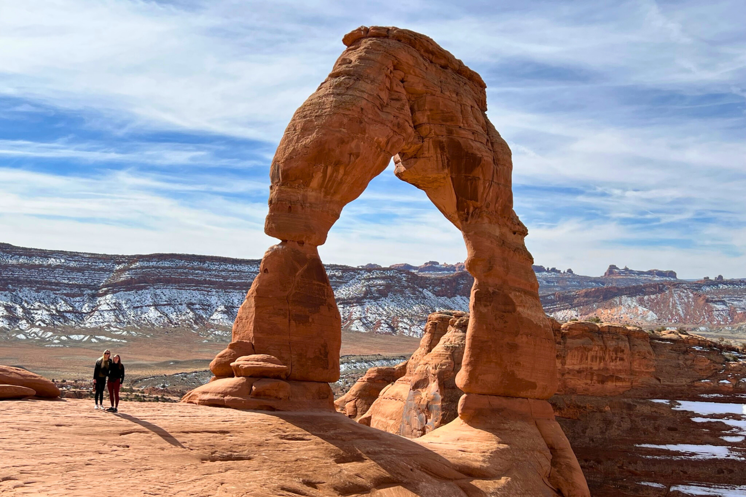
Sunrise Strategy: Arches is CROWDED. Your only hope of avoiding the masses is to enter at sunrise or after 5 pm. I strongly recommend sunrise at Delicate Arch.
Pre-Dawn: Delicate Arch (3 miles, moderate-strenuous)
Utah's most iconic arch requires a 3-mile round-trip hike across slickrock. It's worth every step.
Logistics:
Arrive at the trailhead by 5:30 am (earlier in summer)
Park fills by 6 am, seriously, this is non-negotiable
The hike is exposed (no shade) and steep at the end
Sunrise hits the arch around 7 am in summer, 6:30 am in spring/fall
Why Dawn?:
Fewer people (you might have 15 minutes alone with the arch)
Perfect light; the arch glows orange
Cooler temps for the exposed hike
Mid-Morning: Park Avenue & Courthouse Towers (Return to Car)
After sunrise at Delicate Arch, drive back toward the entrance and hike the Park Avenue Trail (1 mile, easy, one-way shuttle hike) or just drive the scenic road, photographing formations:
Courthouse Towers
Balanced Rock (0.3-mile loop)
The Windows Section (multiple arches, short walks)
Midday: Return to Moab, Rest & Refuel
You started at 5 am. You've earned lunch and a nap. Grab food at Love Muffin Cafe or Eklecticafe.
Late Afternoon: Devils Garden
Return to Arches around 4 pm when crowds thin. Drive to the end of the park road forthe Devils Garden Trail.
Options:
Short version: Landscape Arch (1.6 miles, easy) - One of the world's longest natural arches
Long version: Primitive Loop (7.2 miles, strenuous) - Adds Double O Arch, Dark Angel
Evening: Sunset at Delicate Arch Viewpoint (if you didn't hike) or Garden of Eden viewpoint (easy access, great light).
Post-Dinner: Hit up Moab Brewery or Proper Brewing for local craft beer.
Book timed entry for Arches on Recreation.gov (required April-October, 7am-4pm, $2 fee)
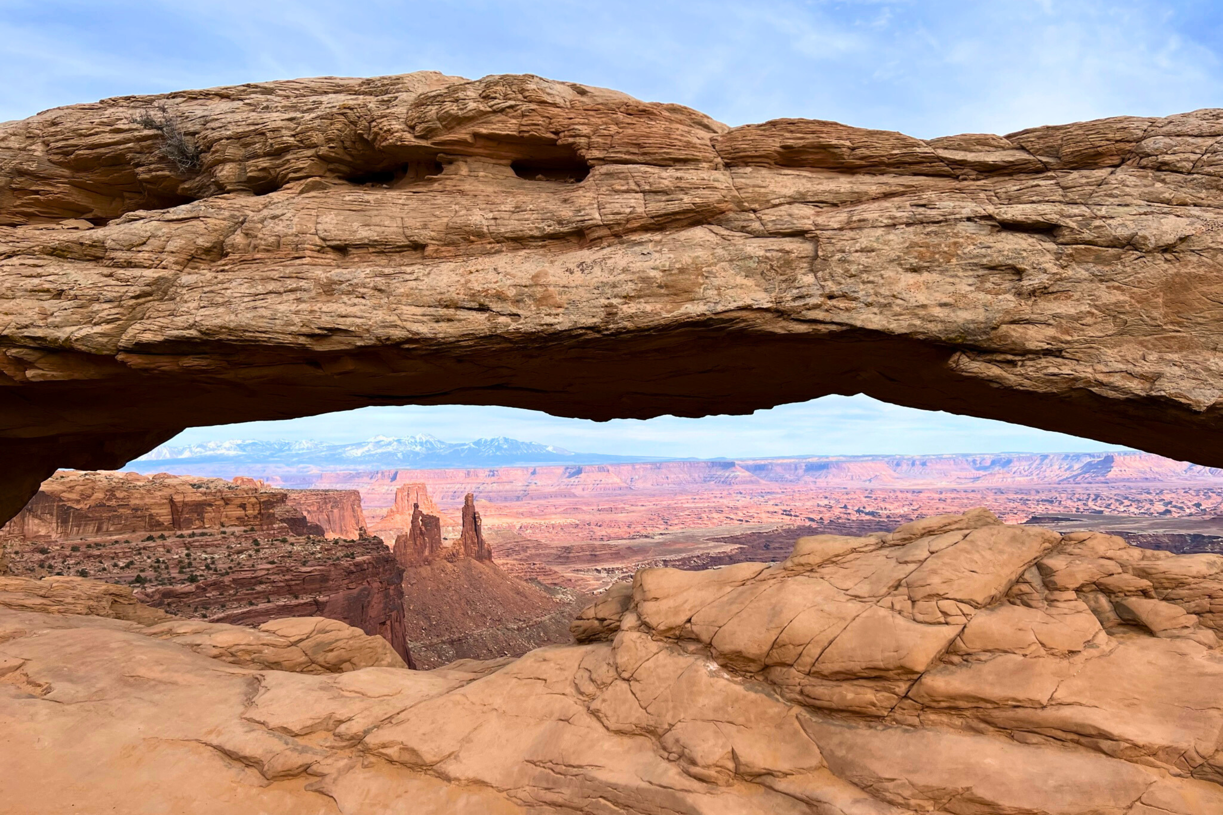
Day 9: Canyonlands National Park
Canyonlands is massive, larger than Zion and Bryce combined. It's divided into four districts, and you can't drive between them. For this trip, we'll focus on Island in the Sky.
Morning: Island in the Sky District
Drive: 45 minutes from Moab
This mesa-top district offers some of the most expansive views in the Southwest, as you're looking down on thousands of square miles of canyons carved by the Colorado and Green Rivers.
Must-See Stops:
Mesa Arch (0.5 miles, easy) - Famous sunrise arch (crowded at dawn, go mid-morning)
Grand View Point Overlook (end of the road) - Walk to the point for 360° views
Green River Overlook - See the river 1,000 feet below
Upheaval Dome (optional 1-mile hike) - Mysterious geological formation (meteor impact or salt dome? Geologists still debate)
Hike: Murphy Point (3.6 miles, moderate)
Less-crowded alternative with equally stunning views. The trail follows the canyon rim, ending at a dramatic overlook.
Optional Afternoon: The Needles District
If you have energy and time, The Needles (90 minutes from Island in the Sky) offers a completely different landscape: red and white striped spires, arches, and slot canyons.
Best hike: Chesler Park Loop (11 miles) or Cave Spring Trail (0.6 miles, easy, historic cowboy camp)
Reality Check: The Needles requires most of the day. If you're tired, spend the afternoon exploring Moab's shops and enjoying a relaxed pace.
Evening: Moab Town Time
Shop: Gear Trader (used outdoor gear, great deals), Moab Rock Shop (local minerals)
Walk: Explore Mill Creek Parkway (paved path along the creek)
Treat Yourself: Jailhouse Cafe for breakfast-for-dinner (best pancakes in Utah)
STAY AT:
Optional Day 10: Monument Valley or Dead Horse Point
You have three options for your final day, depending on energy levels and interests:
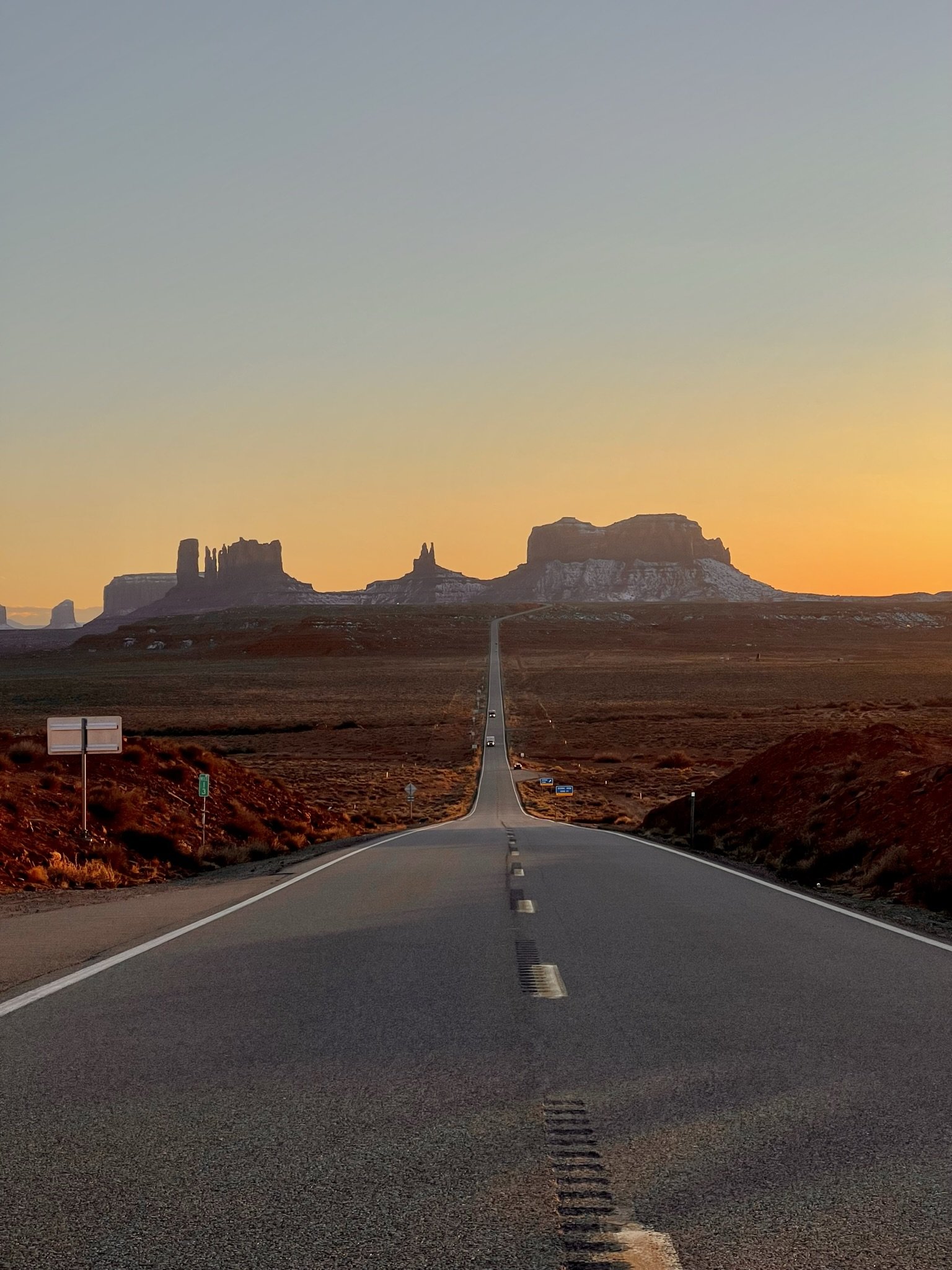
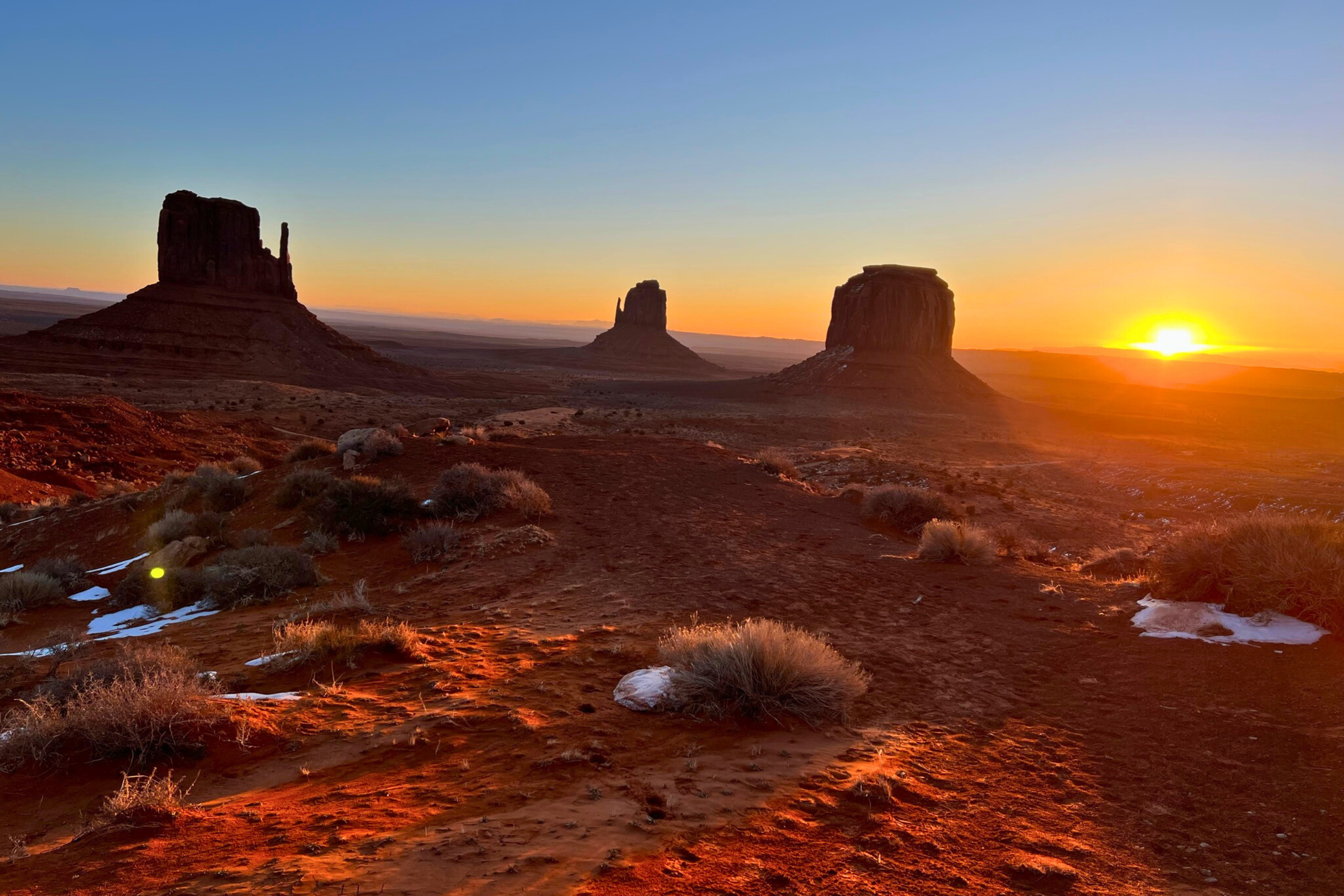
Option 1: Monument Valley (3 hours from Moab)
The Iconic Southwestern Landscape
Those buttes rising from the desert floor? They're the backdrop of countless Western films and are sacred to the Navajo Nation.
Important: Monument Valley is on Navajo Nation land. You're a guest here. Respect signage, stay on designated roads, and hire a Navajo guide if you go beyond the main loop.
What to Do:
17-Mile Scenic Loop (2-3 hours, requires high-clearance vehicle or SUV)
Hire a Navajo guide for access to restricted areas and cultural context (worth every penny)
Stay at the View Hotel for panoramic window views and good food
Why This Matters: Monument Valley isn't just scenery; it's the heart of Navajo culture. Taking a tour led by a Navajo guide transforms this from tourism into education. You'll learn about the landscape's spiritual significance, hear stories passed down through generations, and leave with a deeper understanding.
Book a Navajo-guided tour through Monument Valley, which directly supports the local community.
Option 2: Dead Horse Point State Park (30 minutes from Moab)
The "Mini Grand Canyon"
Often called the most spectacular view in Utah, Dead Horse Point overlooks a dramatic bend in the Colorado River, 2,000 feet below.
Why It's Special:
Smaller and quieter than national parks
Easier access than Canyonlands' best viewpoints
Stunning sunset location
Mountain biking trails, if you're into that
What to Do:
Walk the Rim Trail (multiple access points, short sections)
East & West Rim Overlooks (both spectacular)
Watch for the Colorado River's massive meanders below
Photography Tip: Blue hour (just after sunset) here is magical, the canyon glows purple and orange.
Option 3: Relax & Drive Back to Vegas (6 hours)
The Honest Choice
You've hiked 50+ miles, driven 1,500 miles, and woken up at 5 am multiple times. It's okay to spend this morning sleeping in, having a leisurely breakfast, and enjoying the drive back.
Scenic Route Home:
Take Highway 128 along the Colorado River (adds 30 minutes but is worth it)
Stop at Fisher Towers (quick photos)
Lunch in Green River at Ray's Tavern (famous burgers, cash only)
Return via I-70 to I-15
Hidden Gems & Off-the-Beaten-Path Stops
These are the places that didn't fit the main itinerary but are worth knowing about:
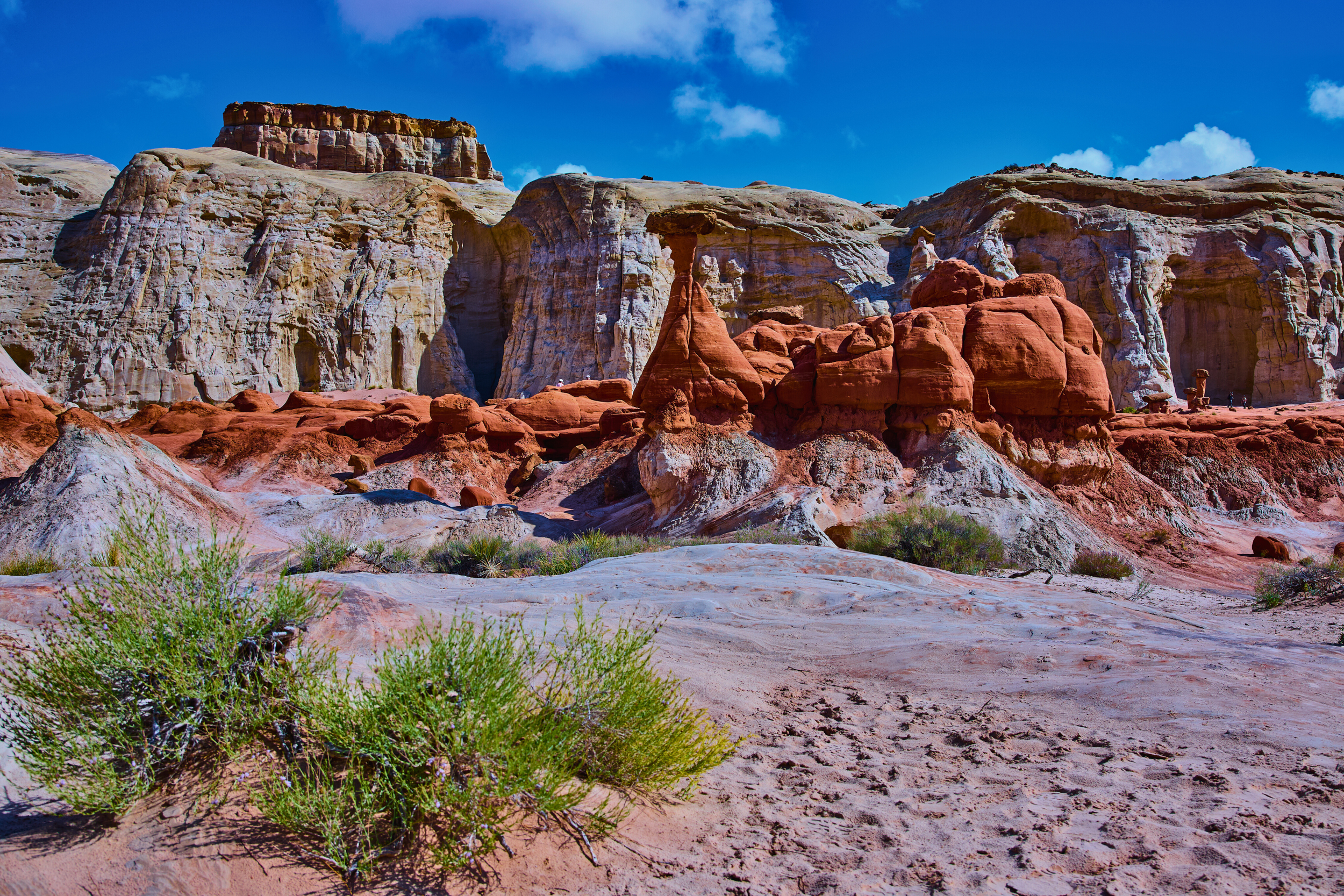
Goblin Valley State Park (Mars on Earth)
Location: Between Capitol Reef and Canyonlands (add 1 hour to drive)
Thousands of mushroom-shaped rock formations (called "goblins") cover the valley floor. It looks like another planet—NASA used it as a Mars analog for training.
What Makes It Special: Unlike national parks, you can climb on the formations here. It's a playground for adults and kids alike.
Best For: Families, photographers, anyone who wants to feel like they're on Mars
Snow Canyon State Park (Near St. George)
Location: 15 minutes from St. George (add to Day 1 or end of trip)
Red and white Navajo sandstone, ancient lava flows, and significantly fewer crowds than Zion.
Best Hikes:
Jenny's Canyon (easy slot canyon)
Lava Flow Trail (walk on 27,000-year-old lava)
When to Go: Winter! When Zion is cold, Snow Canyon is perfect (despite the name, it rarely snows here).
Boulder, Utah (Population: 226)
You passed through on Day 6, but Boulder deserves more attention.
Why It Matters: Boulder was the last town in the continental US to receive mail by mule train (until 1935). It remains one of the most remote communities in America, and that isolation has preserved something rare: authenticity.
What to Experience:
Anasazi State Park Museum - Well-preserved Ancestral Puebloan village site
Boulder Mountain Lodge - Stay here if you can; the gardens are stunning
Hell's Backbone Grill - Already mentioned, but worth repeating
The Wave (Lottery-Based Access)
Location: Coyote Buttes, Arizona (near Kanab)
The most photographed slot canyon formation in the Southwest, swirling, striped sandstone that looks photoshopped.
The Catch: Only 20 people per day are allowed in (10 online lottery, 10 walk-in lottery). Odds are about 1 in 100.
Is It Worth Trying? If you're flexible with dates, apply for the online lottery 4 months in advance. Don't plan your trip around it, but if you win, it's unforgettable.
Apply: Lottery System
Cultural & Intentional Travel Tips
Indigenous Land Acknowledgment
Every landscape you'll visit on this trip has been home to Indigenous peoples for thousands of years, and in many cases, still is.
Whose Land?
Zion & Bryce: Kaibab Band of Paiute Indians, Southern Paiute Tribes
Escalante & Capitol Reef: Fremont culture (ancestors), modern Paiute
Moab/Arches/Canyonlands: Ute Tribe, Navajo Nation (historic)
Monument Valley: Navajo Nation (Diné)
How to Engage Respectfully:
Visit tribal museums and cultural centers (Moab Museum, Anasazi State Park)
Hire Native guides when available (especially at Monument Valley)
Never touch petroglyphs or remove artifacts (it's illegal and disrespectful)
Learn basic history, this wasn't "uninhabited wilderness" when settlers arrived
Supporting Local Communities (Not Chains)
Small towns in Southern Utah are economically fragile. Your choices matter.
Where to Spend Your Money:
Independent lodges and inns over chain hotels
Locally-owned restaurants (skip fast food when possible)
Local outfitters for gear and tours
Small-town coffee shops (conversation with locals is priceless)
Artists and craftspeople (many galleries feature Indigenous artists)
Leave No Trace in the Desert
The desert is more fragile than you think. One footprint off-trail can take decades to heal.
7 Leave No Trace Principles for Desert Travel:
Stay on trails - Cryptobiotic soil (black, crusty ground) takes 50-250 years to regenerate if stepped on
Pack out ALL trash - Even organic waste (apple cores attract rodents, disrupting the ecosystem)
Use established campsites - Don't create new fire rings or tent spots
Poop at least 200 feet from water - Bury 6-8 inches deep (pack out TP in slot canyons)
Don't move rocks or "improve" campsites - What looks messy serves a purpose
Respect wildlife - Don't feed animals (even cute chipmunks; it harms them)
Leave artifacts alone - Pottery shards, arrowheads, etc., are protected by federal law
Special Desert Considerations:
Water is sacred - Springs are lifelines for wildlife. Don't contaminate or camp directly next to them
Quiet matters - Sound travels far in canyons. Keep noise low to preserve solitude for others
Cairns (rock stacks) - Only follow official trail cairns. Don't build your own; it confuses hikers and disrupts ecology
Practical Road Trip Tips
Gas Station Strategy (They're Far Apart!)
Reality Check: You can go 100+ miles between gas stations in parts of this trip.
Never Let Your Tank Drop Below Half on these stretches:
Highway 12 between Escalante and Torrey
Highway 24 between Torrey and Hanksville
Highway 191 south of Moab
Gas Prices:
Expect $0.50-1.00/gallon more in small towns than in cities
Most expensive: Escalante, Boulder, small highway stops
Fill up in: St. George, Richfield, Moab (larger towns = better prices)
Water & Hydration in the Desert
How Much to Bring: 1 gallon per person per day minimum, more if hiking.
Signs of Dehydration:
Dark yellow urine
Headache
Dizziness
Dry mouth
Desert Hydration Tips:
Start hydrating the day BEFORE a hike
Drink before you're thirsty (if you feel thirsty, you're already dehydrated)
Bring electrolyte tablets (Nuun, Liquid IV) for long hikes
Avoid alcohol the night before big hiking days
Water Sources:
Fill bottles at visitor centers (free, filtered)
Most trailheads do NOT have water
Towns have potable water at gas stations and stores
Rapid Hydration (essential for desert hiking)
LifeStraw Go Series Water Filter (for backcountry water sources)
Avoiding Crowds: Time of Day Strategies
The Golden Rules:
Start early - Be on the trail by 7 am for popular hikes
Lunch lull - Most tourists eat 12-1 pm. Hike during this window.
Late afternoon resurgence - 3-6 pm is busy again
Sunset solitude - After 6 pm, crowds thin dramatically
Specific Strategies:
Zion: First shuttle at 6 am or after 4 pm
Arches: Sunrise or after 5 pm (park entrance gets lines 9 am-3 pm)
Bryce: Early morning or late afternoon (hoodoos look best in angled light anyway)
Skip the Crowds Entirely:
Go to Escalante while everyone else is at Zion
Choose Capitol Reef over Arches on weekends
Explore Kolob Canyons instead of the main Zion
FAQ for Visiting Southern Utah
-
Seven days is possible for a whirlwind tour of the Mighty 5, but you'll be driving 3-4 hours daily and won't have time for hidden gems like Escalante or cultural experiences. Ten days is ideal for experiencing Southern Utah without feeling rushed, allowing time for spontaneous stops and deeper exploration.
-
The most efficient route is: Las Vegas → Zion → Bryce Canyon → Capitol Reef → Arches → Canyonlands → Return via I-70. This loop covers approximately 1,000-1,200 miles and minimizes backtracking. Add Escalante and Highway 12 between Bryce and Capitol Reef for the ultimate experience.
-
Yes! All parks have scenic drives with incredible viewpoints accessible by car. Recommended drives: Zion Canyon Scenic Drive (shuttle required), Bryce Canyon scenic road, Arches scenic drive, and Capitol Reef's scenic drive. However, you'll miss the best experiences—even short 1-2 mile hikes reveal landscapes you can't see from the road.
-
Yes, Southern Utah is very safe for solo travelers. The main safety concerns are environmental (heat, flash floods) rather than crime. Standard precautions: tell someone your hiking plans, carry extra water, check weather before slot canyons, and stay on marked trails. Park visitor centers have rangers who can advise on current conditions.
-
April: Daytime temps 60-75°F, nights 35-45°F. Possible rain (actually beautiful in the desert). Wildflowers bloom mid-April. Pack layers—mornings are cold, afternoons warm. Some high-elevation roads may still have snow.
October: Daytime temps 55-70°F, nights 30-40°F. Fall colors peak late September-early October. Increasingly crisp air, excellent for hiking. Less crowded than spring. Perfect weather overall.
-
Rattlesnakes are present but rarely encountered. They're most active from April to October during warm weather. Stay on trails, watch where you place your hands when scrambling, and don't hike after dark. If you see one, give it space—they're more afraid of you.
-
Yes! Winter (November-March) offers solitude, stunning snow-on-red-rock views, and unique photo opportunities. Challenges: Some high-elevation roads close (Bryce's scenic road, parts of Highway 12), shorter days, and cold nights. Zion, Arches, and parts of Capitol Reef are accessible year-round. Come prepared for winter hiking and driving.

The Scenic Route Traveler inspires intentional travel through storytelling, hidden gems, and culturally rich experiences around the world.
-
I’m Erin, the voice behind Scenic Route Traveler, sharing intentional travel stories and guides from around the globe.
-
We deliver travel guides and storytelling through YouTube, social media, photography, and digital products designed for fellow travelers.
-
If you’re new here: this is a space for travelers who care more about how a place feels than how it looks on a checklist. You’ll find guides, stories, and resources designed to help you slow down and travel with intention.